Practical Steps for Sharing Processed Aerial Data with Your Team
Why Sharing Processed Aerial Data Needs a Plan
You have flown a drone mission, processed the images into orthomosaics, point clouds, or 3D models, and now you need to get that data into the hands of colleagues, clients, or partners. Simply emailing a huge file or dropping a link into a chat rarely works. Files are too large, recipients may lack the right software, and version confusion can stall decisions. A solid approach to sharing processed aerial data makes sure everyone sees the same current information without friction.
This article walks through the main steps for distributing drone-derived outputs efficiently. It covers file preparation, access control, communication, and follow-up. The goal is to keep stakeholders informed and able to act on the data, not to get bogged down in technical snags.
Step 1: Know Your Audience and Their Tools
Before exporting or uploading anything, think about who will use the data and what they need to do with it. A surveyor might want a full-resolution orthophoto in GeoTIFF format. A project manager may only need a lightweight PDF map with annotations. A client could prefer to view the model in a web browser without installing any software.
Matching the output format to the recipient's workflow saves time. If you send a massive point cloud to someone who only needs elevation contours, you create extra work. Ask a few quick questions: What software do they have? Do they need to measure distances, or just look at the big picture? How fast does their internet connection download large files? The answers guide your choices for compression, resolution, and delivery method.
It also helps to confirm whether recipients have permission to view sensitive data. Some projects involve restricted areas or proprietary information. Make sure you know the access rules before you share anything.
Step 2: Prepare the Data for Smooth Sharing
Raw processing outputs are often huge. A single orthomosaic from a 50-hectare site can exceed one gigabyte. Few stakeholders want to wait through a long download. Compression and tiling can help without losing essential detail.
Consider these common formats and their trade-offs:
- Cloud-optimized GeoTIFF (COG), works well for online viewers; the server serves only the tiles the user requests, so load times are fast.
- Web maps (e.g., PNG tilesets or MBTiles), ideal for embedding in a web map or a simple GIS application.
- 3D models as glTF or OBJ, lightweight enough for browser-based 3D viewers, though heavy models may need simplification.
- PDF with embedded map, good for quick reports and printed plans, but not suitable for detailed analysis.
- Compressed LAS (LAZ) for point clouds, reduces file size by about 60-80% compared to standard LAS.
Whichever format you choose, verify the data integrity before sharing. Check that the coordinate system is embedded correctly, that the resolution matches your claim, and that no tiles are missing or corrupted. A quick visual check in a free viewer can catch mistakes that would otherwise erode trust.
Step 3: Choose a Delivery Method
The right delivery method balances security, ease of access, and file size. Here are common options and when they work best.
Cloud storage with shared links
Services like Google Drive, Dropbox, or OneDrive are familiar and simple. You upload the processed files and generate a link. You can set expiration dates or password protection. This works well for small to medium-sized folders sent to a few people. The downside is that very large files can still be slow, and some recipients may need to sign up for an account to download.
Specialised data platforms
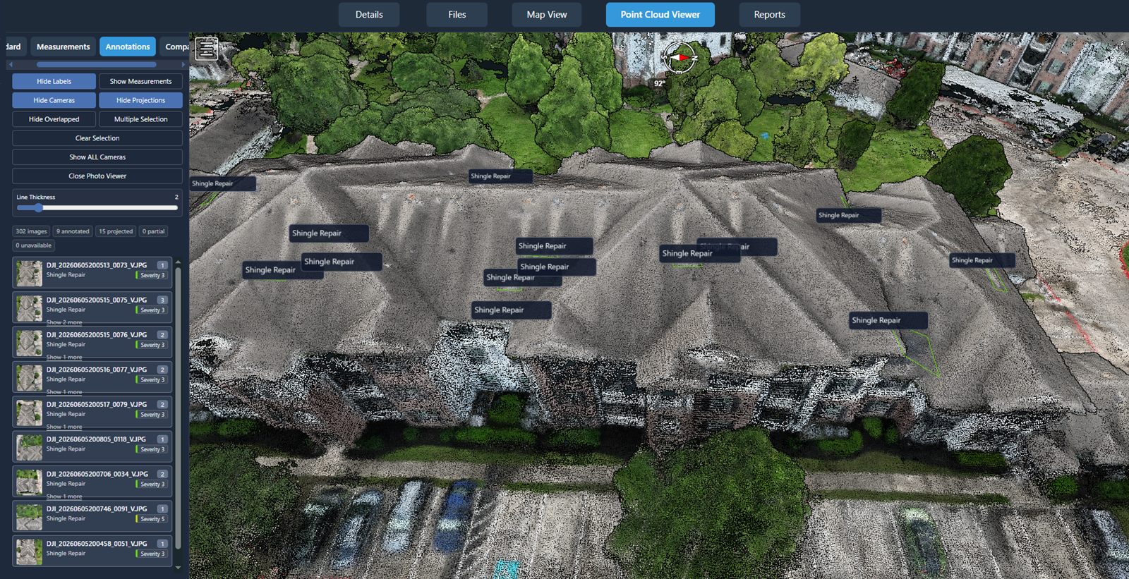
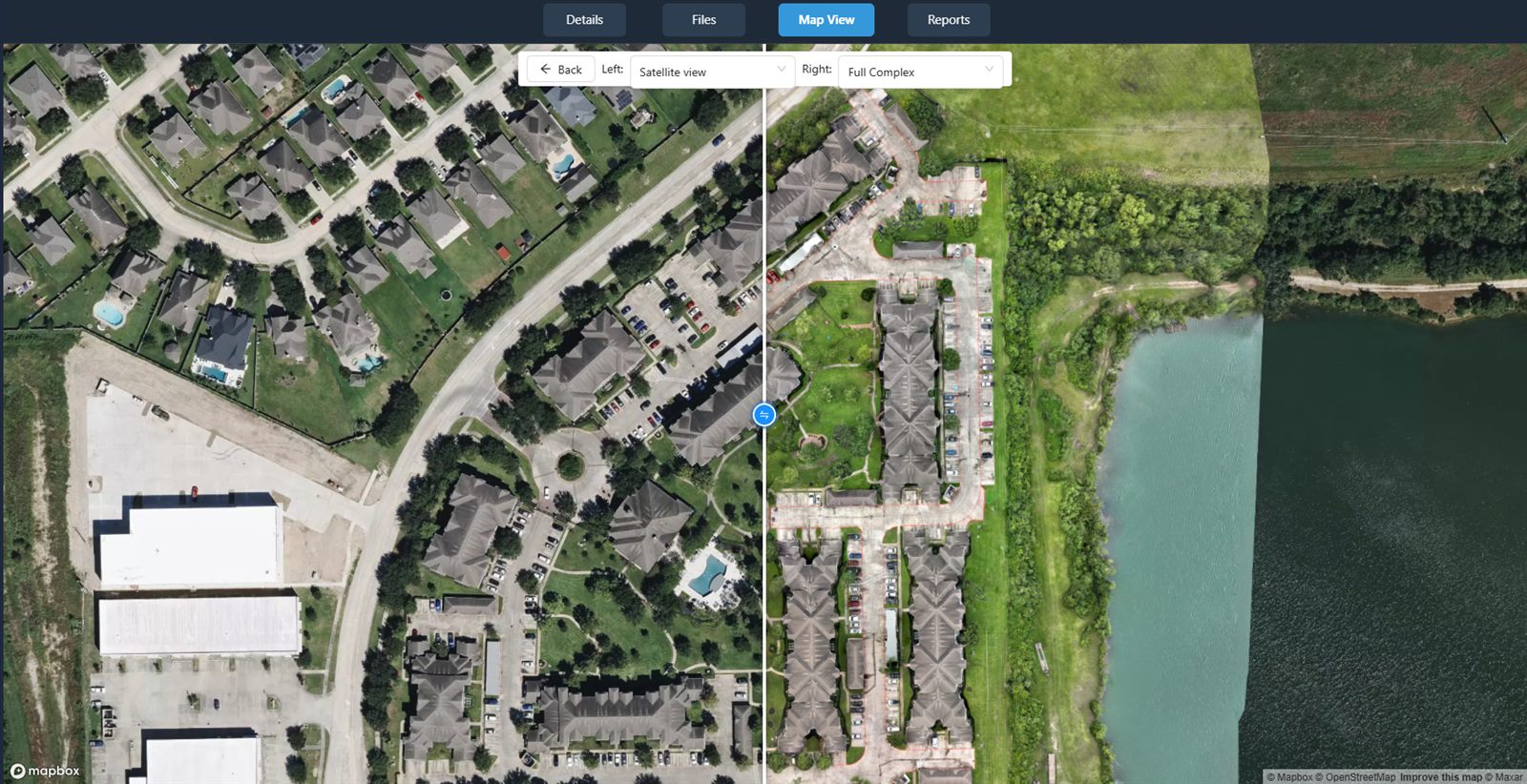
Platforms built for drone data management offer features that generic cloud storage lacks. They typically host the data in a viewer that lets stakeholders pan, zoom, measure, and compare versions without downloading anything. Access can be set per user or per project, and audit logs show who viewed or downloaded what. For many teams, this approach reduces confusion because everyone works from the same hosted version.
One example of such a platform is National Drone Services, a system designed for uploading, processing, organizing, visualizing, comparing, measuring, and sharing drone aerial data. Using a platform like this means you control permissions at a fine level and can revoke access when the project ends.
File transfer protocol (FTP) or secure file sharing
For very large datasets or clients with strict security policies, FTP or enterprise-grade file sharing (e.g., Aspera, Signiant) may be necessary. These methods are faster over long distances and support resumable transfers. They require more setup on both ends, so reserve them for repeat transfers or projects with many files.
Step 4: Set Clear Permissions and Expiration
Once you have uploaded the data, define who can see what. Not every stakeholder needs the full raw output. A client might only need the final orthomosaic, while your field team might need the point cloud for cross-section analysis. Role-based access keeps the project organized and reduces the chance of accidental edits or leaks.
Expiration dates are a good practice. If you share a link that never expires, stale data can circulate long after the project ends. Set a reasonable window, such as 90 days, and notify stakeholders before the link expires so they can download what they need. Some platforms let you set an automatic expiration when you create the share.
Step 5: Communicate What You Are Sharing
Sending a link with no explanation causes confusion. Write a short message that includes:
- What the data covers (area, date, type of processing)
- What the recipient should look for (e.g., "check the northwest corner for the new drainage line")
- Any known limitations (e.g., "the orthomosaic has some cloud shadows in the southern sector")
- What software or viewer to use, with a link to instructions if needed
If you are using a platform with a built-in viewer, mention that no additional software is required. This lowers the barrier for non-technical stakeholders. Keep the tone professional but helpful. A short video walkthrough (under two minutes) can also be useful, but text is usually enough.
Step 6: Follow Up and Collect Feedback
Sharing is not the end of the process. After a few days, check whether recipients have accessed the data and if they have questions. Sometimes a stakeholder opens the file but cannot find the layer they need, or they interpret the colors incorrectly. A brief check-in can prevent misunderstandings that delay decisions.
Ask what worked and what did not. Was the file too large? Was the coordinate system wrong? Did the viewer load slowly? Use that feedback to adjust your process for the next share. Over time, you will build a repeatable workflow that minimizes back-and-forth.
Common Pitfalls to Watch For
Version confusion. If you share the same area multiple times, label each version clearly with a date or a version number. Never rely on "final_final_ortho.tif" naming.
Ignoring coordinate system metadata. A file without embedded CRS (coordinate reference system) will appear in the wrong place when opened in GIS software. Always embed the CRS during export.
Sharing raw instead of processed data. Stakeholders generally do not need the original drone images. They need the processed outputs. Sending raw files wastes their time and your bandwidth.
Forgetting to revoke access. When a project ends, remove or expire the share links. This is especially important for sensitive data such as construction progress or environmental survey results.
Platforms like National Drone Services handle many of these concerns automatically, but even with a good tool, the human steps of communication and follow-up matter most.
Building a Repeatable Workflow
After a few projects, you will settle on a routine: select the right format, upload to a shared space, set permissions, send a clear message, and follow up. Document that routine so new team members can adopt it. A short checklist kept in a shared document prevents skipped steps.
Good drone data management is not just about processing. It is about making the processed data useful to the people who need it. When sharing is seamless, stakeholders can make faster, better-informed decisions, and the value of the aerial data increases for everyone involved.
National Drone Services on social media
 Facebook